Assala is a digital tool designed to meet the needs of technicians and decision-makers in natural resource management companies. It adapts to worldwide contexts and other use cases.
Expands the toolkit of cartographers and forest operations managers
Saves time in planning operations thanks to tailored, high-performance algorithms
Allows users to bring their own data and configure their operating rules
Helps analyze the performance of planned or existing networks, reducing construction and maintenance costs
Keeps social and environmental impacts and greenhouse gas emissions under control
Enables you to monetize results on voluntary carbon and biodiversity credit markets
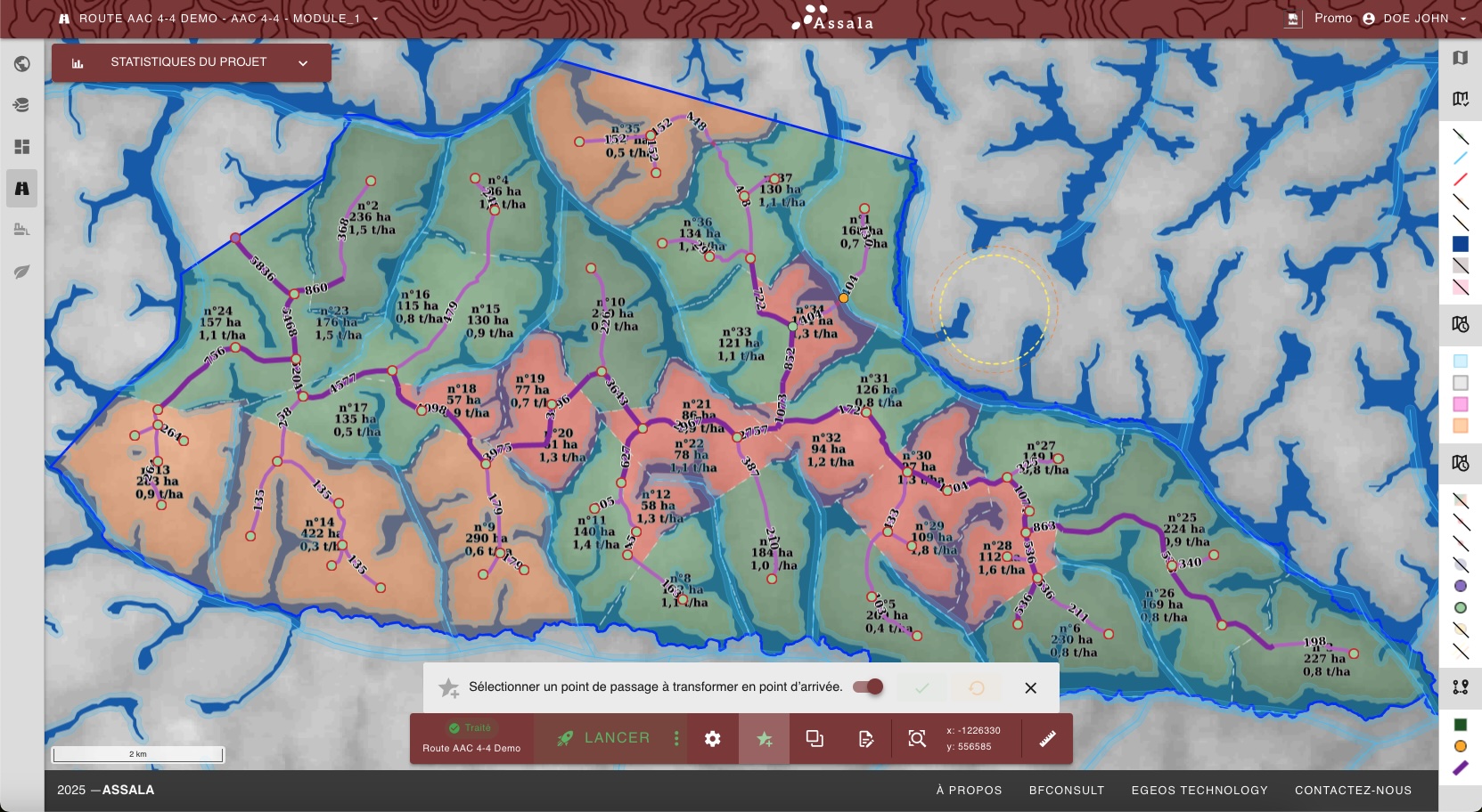
Design and optimize a coherent road network. Identify harvesting pockets, simulate alternatives, control connection angles, slopes, and exclusion zones.
Generate trails that connect trees to roads and place log yards as close as possible to constraints and costs. Prioritize efficiency and productivity.
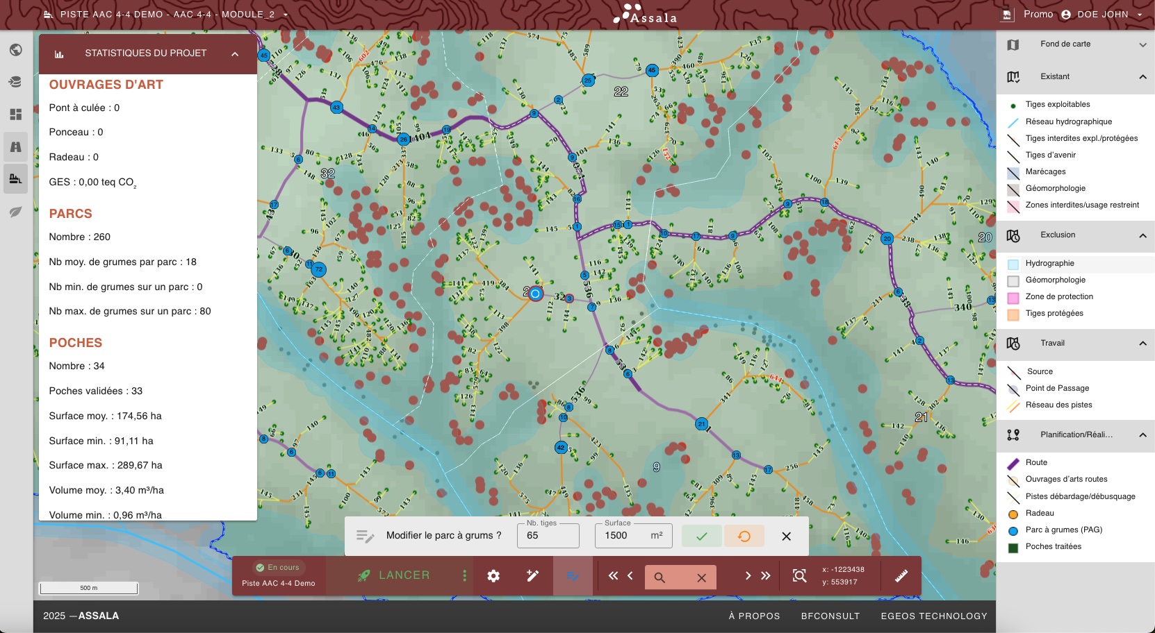
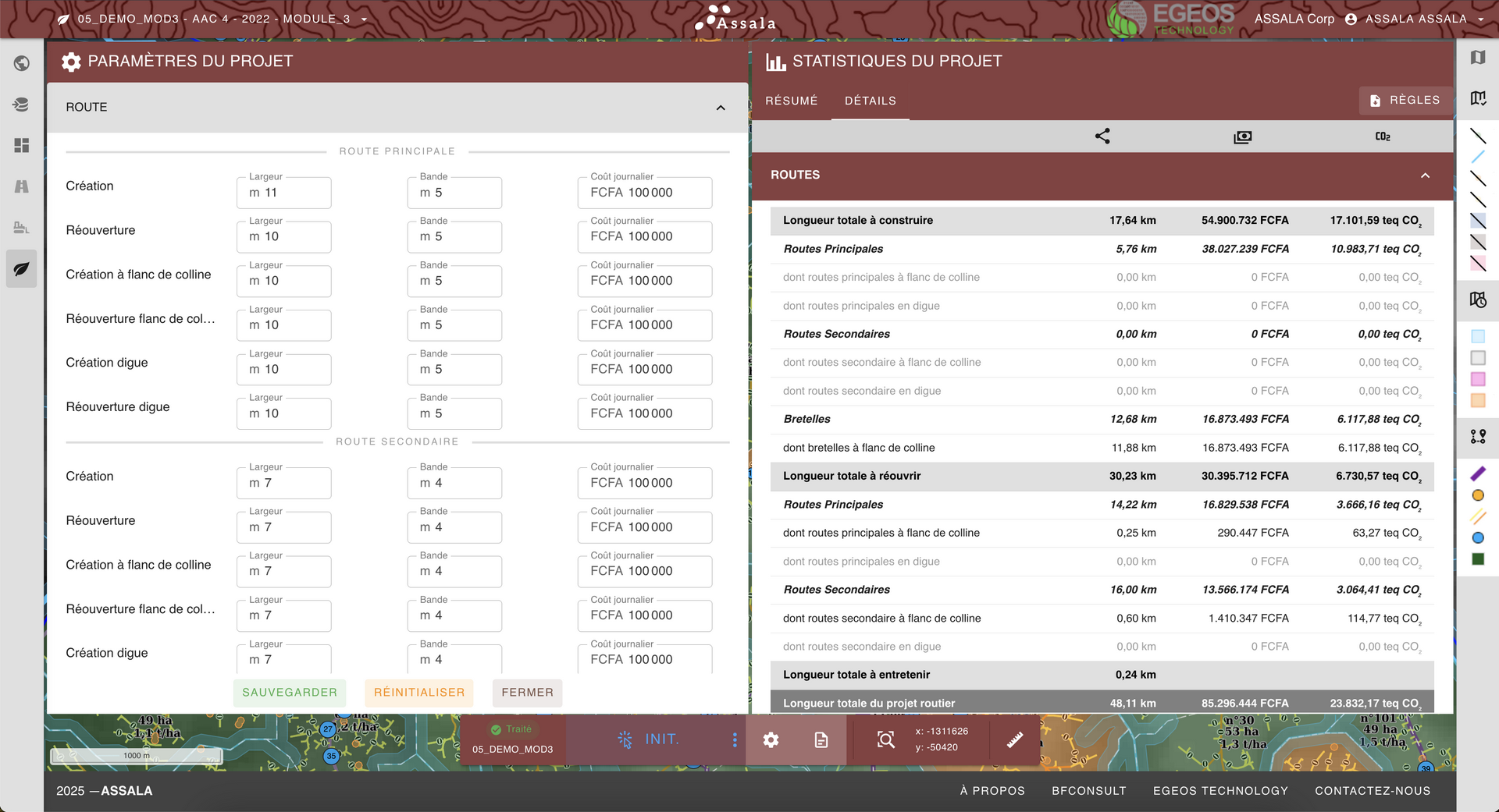
Measure the financial and environmental impact of your choices. Consolidate costs and emissions (CO₂eq) at the project scale and compare scenarios.
All modules included. One license per concession.
Pay only for what you need.
Integration & deployment within your infrastructure
Assala is a webGIS application available in the browser that optimizes road and trail planning to reduce costs, greenhouse gas (GHG) emissions, and the environmental impact of a road network.
ASSALA is immediately available through a secure URL. No software needs to be installed locally. You only need a modern browser such as Chrome, Firefox, Edge, or Safari.
Yes. We offer a version that can be deployed on your servers or private cloud (Docker container), with technical support during installation and updates.
The interface is designed for forestry technicians and engineers. A short training course (1 to 2 days) makes you operational. We provide guides, videos, and resources.
Yes. Remote onboarding is provided when ASSALA is set up, and baseline support is included in the license. A user guide is available inside ASSALA. For specific needs or customized on-premises deployments, additional services can be delivered by our sales team.
ASSALA supports the standard GIS Shapefile format. Exports can be produced in Shapefile (.shp, .dbf) or Excel (.xlsx).
You upload your vector/raster data through the interface. Automatic checks validate quality and guide you in correcting inconsistencies. A best-practices guide for preparing mapping data is available inside ASSALA.
Access to ASSALA is protected by authentication and role-based permissions. Your administrators manage and assign rights to the data, defining access for each user (for example "Administrator" and "Operator" roles). Action logging and strict project isolation further strengthen security.
Data hosting depends on the option you choose. By default, your data is stored on secure servers located in Europe that comply with GDPR. You can also opt for deployment directly within your own infrastructure (on-premises). In every case, export and data portability features keep you in control.
Yes. Rules (connection angles between roads or between roads and trails, maximum slopes, minimum distances, exclusion zones) can be configured per project and per module.
Yes. The interface is available in French, English, Spanish, and Portuguese. Additional languages can be added on request.
Support is available by email and video conference. We offer several levels of assistance: standard (business hours) and premium (24/7). Guides can be accessed directly from the ASSALA interface.